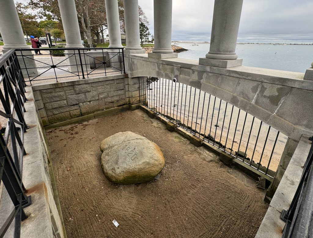
Plymouth Rock
5 min walk
This iconic granite landmark serves as the traditional site of the landing of the Mayflower Pilgrims and is centrally located along the waterfront.

The coastal corridor between Massachusetts capital and the town where the Mayflower landed has carried travelers for four centuries. Today that route runs almost entirely along a modern highway built to cut through the South Shore's glacial topography. This guide breaks down the mileage, the route choices, and the timing windows that separate a smooth drive from a crawl.
Quick answer
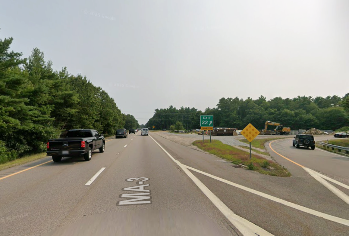
The distance from Boston to Plymouth is approximately 40 miles when traveling via Route 3 South, the most direct highway route. The drive typically takes 50 to 65 minutes under normal traffic conditions. During peak commuter hours—weekday mornings southbound and evenings northbound—that window can stretch to 90 minutes or more, particularly between the Braintree split and the Kingston interchange.
Route 3 did not exist when the Pilgrims made the reverse journey in 1620, but the corridor it follows—hugging the western shore of Massachusetts Bay before cutting inland through pine barrens—has always been the logical line between the two settlements. The modern highway opened in segments between 1951 and 1963, replacing a patchwork of state roads that wound through every South Shore town center. That engineering decision collapsed what was once a two-hour ordeal into a drive measured in miles rather than stops. The 40-mile distance from Boston to Plymouth holds steady whether you depart from the downtown core or the southern neighborhoods, because the effective starting line for most drivers is the interchange where Interstate 93 becomes Route 3 in Braintree. From that junction the highway runs uninterrupted—two lanes in each direction for most of its length—through Weymouth, Hingham, and Duxbury before delivering you to exit 5 or 6A depending on which part of Plymouth you need. The route is free to drive in both directions; Massachusetts abolished the last toll plaza south of Boston in 1989. Expect no payment infrastructure, no gates, and no electronic transponder readers along the corridor. Traffic volume follows the classic commuter pattern: heavy southbound on weekday mornings as workers drive toward the hospitals and offices in Kingston and Plymouth, then heavy northbound in the evening as that flow reverses toward Boston. The window between 10:00 and 14:00 avoids both surges and typically holds the drive to under an hour. Weekend traffic spikes differently—summer Saturdays see beach-bound congestion southbound from mid-morning through early afternoon, and Sunday evenings can slow northbound as travelers return from Cape Cod. The best arrival window for reaching Plymouth falls between late morning and early afternoon, when Route 3 carries its lightest load and the town's own parking supply still has capacity near the waterfront and Plymouth Rock. That timing also aligns with daylight hours year-round, which matters on a route with minimal street lighting south of Duxbury. Winter drivers should note that the highway sits exposed to wind off the bay, and blowing snow can reduce visibility even when precipitation has stopped.
“The 40-mile corridor follows the same glacial geography that shaped the Pilgrims' journey, now compressed into an hour of asphalt and pine.”
Plymouth is located approximately 40 miles southeast of Boston. Visitors typically travel via the South Shore by car or public transit.
Route 3 South
MBTA Commuter Rail Kingston Line to Kingston Station
Plymouth & Brockton Street Railway to Plymouth Center
To ensure a smooth journey, please refer to the best arrival window of 10:00–14:00 to avoid peak commuter traffic on Route 3.
The best arrival window is 10:00–14:00 to avoid peak morning and evening commuter traffic on Route 3. Planning your transit within this timeframe ensures a more predictable journey between Boston and Plymouth.
—
Avoid Route 3 between 06:00 and 09:30. Traffic congestion significantly impacts travel time during these hours.
—
This is the optimal window for travel. Traffic levels are lower, allowing for efficient transit.
70°F to 80°F
Expect heavier traffic on Route 3 due to seasonal visitors. Early or mid-day departures are recommended.
50°F to 65°F
Traffic remains consistent with standard weekday patterns. Aim for the 10:00–14:00 window to maintain a steady pace.
Verdict: The most efficient time to travel is between 10:00 and 14:00 on any weekday to circumvent peak commuter congestion on Route 3.
Upon completing your journey from Boston, several historical and coastal landmarks are located within immediate reach of the town center. These sites allow visitors to explore the maritime and colonial history of the area conveniently on foot.
5 min walk
This iconic granite landmark serves as the traditional site of the landing of the Mayflower Pilgrims and is centrally located along the waterfront.

10 min drive
These living history museums provide context for the colonial era and complement the historical theme of your trip.
3 min walk
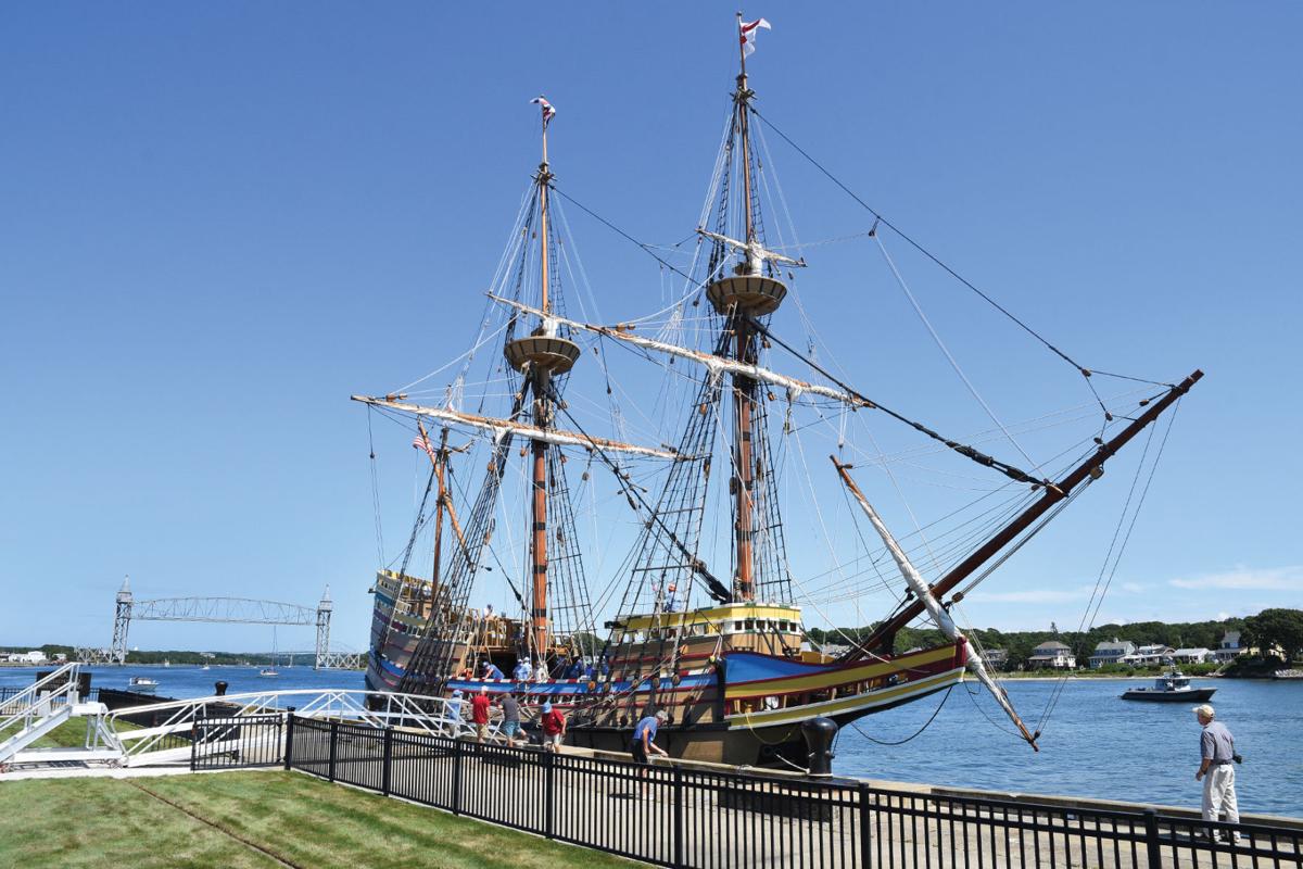
This full-scale reproduction of the ship that brought the Pilgrims to America is docked near the rock, offering an immediate connection to the arrival history.

5 min drive
Standing as one of the largest solid granite monuments in the country, it provides a panoramic view and historical context regarding the individuals who founded the colony.
A smooth trip between Boston and Plymouth depends on checking conditions and confirming details before you leave.
Everything you need to know about distance from boston to plymouth
The distance from boston to plymouth, MA, is approximately 40 miles depending on your specific starting point in the city and destination within the town. This coastal route is well-traveled by visitors heading toward historical landmarks and harbor sites. Planning your path helps ensure a smooth transition from the urban environment to the South Shore. Exploring the route is a popular way to experience Massachusetts history.
Travel time varies significantly based on road conditions and the specific method of transportation. While the geographic span is modest, peak commuter periods on Route 3 can extend travel times considerably. Refer to our specific transportation section for details on transit options and estimated durations. Understanding these logistics is key to enjoying your coastal excursion.
There is a 0 USD entrance fee for access to public roads and highways between these two locations. Please note that while the travel corridors are free, individual historical sites or museums in Plymouth may have their own admission requirements. Always check current listings if you plan to visit specific cultural institutions.
The best arrival window for your trip is between 10:00 and 14:00. Arriving during this period helps you bypass the most congested commuter traffic that frequently impacts Route 3. Planning your schedule around these hours often leads to a more relaxed arrival at your destination.
Yes, the location is ideal for a day trip due to its accessibility. Many travelers appreciate the balance of historical education and maritime scenery that a visit provides. Ensure you have mapped your route in advance to maximize your time exploring colonial sites and the waterfront.
The most common mistake is failing to account for heavy commuter traffic during morning and evening peak hours. We recommend avoiding these times to keep your transit experience pleasant and efficient. Use our site booking tools to secure your spot on guided excursions that handle these logistics for you.
Boston to Plymouth Rock Tour
Read more GuideBoston to Plymouth Public Transportation
Read more GuidePlimoth Plantation from Boston
Read more Tickets & toursBoston to Plymouth Day Trip
Read more GuideBoston to Plymouth Ferry Guide
Read more GuideBoston to Plymouth Train Options
Read more